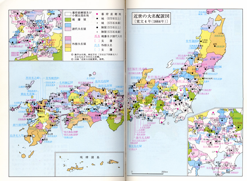
This map shows the distribution of daimyo terrritory after 1664. The maps is color coded:
The size of holdings (in ten-thousands of koku) is shown is light blue or pink Arabic numbers. (For unknown reasons the light blue numbers are for tozama and the pink numbers are for fudai and shinpan). What pattern do you see?